Moving to a new city can be a daunting task, especially if you aren’t familiar with the lay of the land. Luckily, there are some key navigation tools out there that will help you discover what’s nearby. In fact, if you are wondering how to choose a neighborhood for your home search in the first place, these tools can actually lead you to find the perfect location!
In this article, you will learn about 3 key tools that will help you discover what’s close by and other important stats that surround your new city. First, let’s talk about what you should locate when you first move to a new city and why it matters.
What You Should Locate When You First Move to a New City
Here’s something we can all agree on: it’s important to know where the main buildings, shopping centers, and local landmarks are when you decide to move to a new place.
Why? Because it will help you orient yourself to the city and make you feel at home much quicker. Plus, in the case of an emergency, it’s always good to know exactly where the nearest hospitals, pharmacies, police stations, and vet offices are!
Get to Know Your New City
Along with these helpful institutions, you should also be able to locate the nearest:
- Supermarket
- Shopping center
- Children’s school
- Bank
- Post office
- DVA office
- Service provider
- Recreational area
Furthermore, you might even want to look up the hottest local restaurants, entertainment, and cultural attractions, so you can have an enjoyable day out on the town when you first move in!
So, what digital tools can you use to quickly access what’s close by in the city you are planning to move to? Keep reading to learn about the 3 best tools to help you with your search.
1. Big Radius Tool
If you love cold, hard statistics, then the Big Radius Tool offered by StatsAmerica is for you. All you have to do is type in the name of the city or town you plan to move to, and a ton of accredited statistics will pop up for the location! For example, if you want to move to Orlando, simply type in Orlando, click Enter, and within seconds, you will have a full list of informative stats on the city!
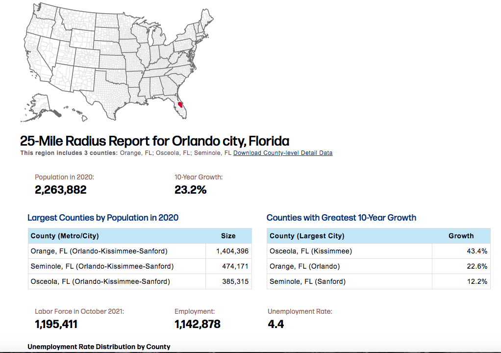
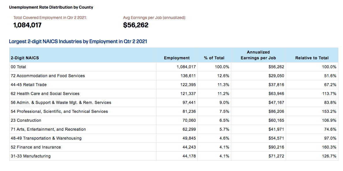
This unique tool will actually let you choose the size of the radius you want to search for, so you can opt between a 25-mile radius all the way up to a 500-mile radius report around the place you search. Then, the tool will show you updated stats on:
- Regional counties
- Size of counties in the area
- 10-year growth of each county
- Employment and unemployment rates
- Average earnings per job
- Largest industries in the area
Why Use the Big Radius Tool?
This is a great tool to use if you want to learn how to choose a neighborhood for your home search because you can take a look at the size and growth of specific counties in the area. This can help you figure out which county to live in. Then, you can research and narrow down the best of the best neighborhoods in that particular area. It’s also especially useful if you want to search for the top industries in the area so you can see if it’s a promising location for your desired job.
Want to know the best part? All of the information is sourced from the U.S. Census Bureau, the U.S. Bureau of Labor Statistics, and several other accredited institutions, so you can trust that it is well-researched and accurate.
2. Google Maps
Wouldn’t it be great to explore your new city from the comfort of your couch – even before you move there? Well, you’re in luck! A tool for this actually exists, and it’s called Google Maps! This easy-to-use navigation system allows you to search for areas of interest, things to do, or notable locations in and around your city. According to Google, you can find places like nearby museums, new restaurants, and popular bars and clubs. You can even see ratings and descriptions of these places in Maps!
Find Top-Rated Neighborhoods & Nearby Amenities
With that being said, if you are still searching for the perfect neighborhood to live in, then Google Maps can help you with your research!
For example, you can type in “Tampa neighborhoods” in your Google Maps search bar, and in an instant, over a dozen well-known neighborhoods will appear on your screen! You can then click on a neighborhood that interests you and find more details about the place, including images, local restaurants, and activities in the area.
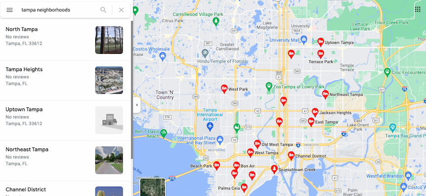
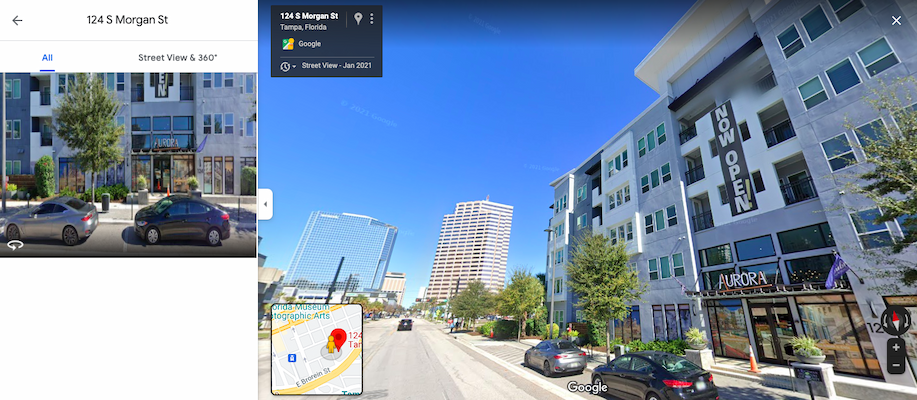
You can then click on a neighborhood that interests you and find more details about the place, including images, local restaurants, and activities in the area. You can even access a birds-eye view of places that you are interested in when you click the Satellite or Street view options!
If you thought Google Maps was pretty extraordinary, just wait until you hear about this next navigation tool.
3. Oalley
Similar to Google Maps, Oalley is an app that lets you calculate the distance between you and specific locations in your new city. In particular, it will tell you the time it will take to walk, bike, or drive from one place to another. Unlike Google Maps, however, Oalley casts a “larger net,” so to speak, and lets you see a full radius of all the places you can drive to in a set time range. For instance, if you type in Dallas and cast a 1-hour net to drive around the city, the app will show you exactly where you can go within an hour by car.
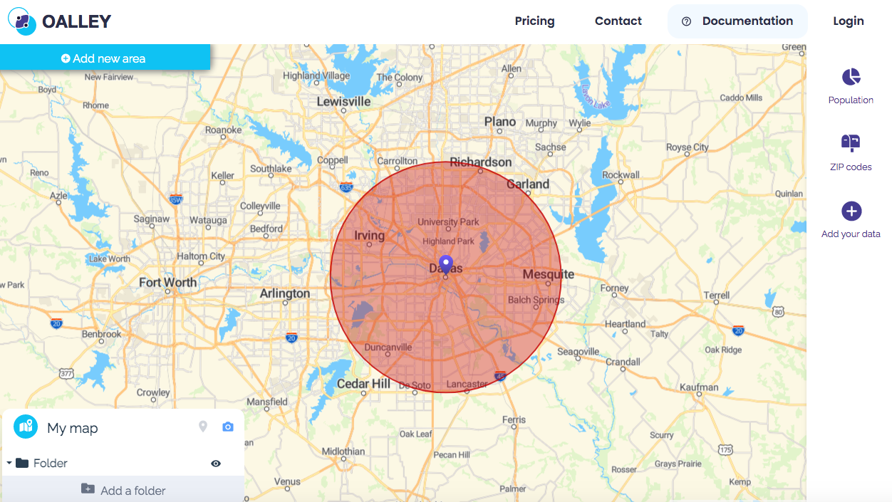
Other useful features Oalley offers include a “Population” and a “Zip Codes” feature. Like the Big Radius Tool, these features allow you to research the statistics of the specific city you are searching.
Find the Perfect Place to Live with Richman Signature
With these 3 navigation tools on your side, you can get to know the ins and outs of your city a little bit better before you make your move. If you haven’t settled on a place to move into yet, Richman Signature can help! At Richman Signature, we offer stunning luxury apartments from coast to coast, so you live in the most beautiful locations across the nation. All of our communities offer exclusive Signature Perks that will give you unique benefits that will help you explore your new city.
See our locations to find a Richman Signature property in the city you plan to move to next!


